
The south contact is open.
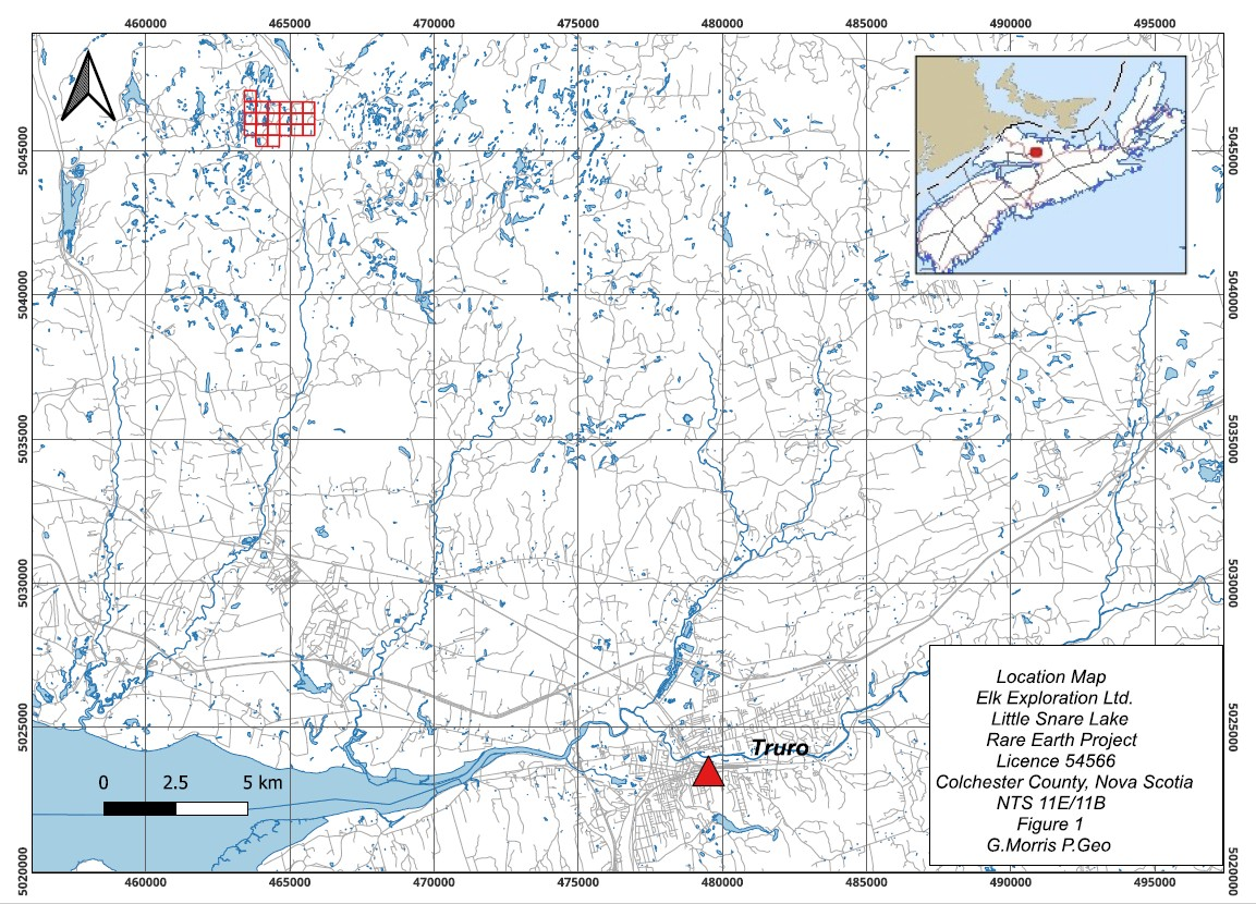
EL 54566. Twenty-one claims on the lake Lindsay said would matter, in good standing. Mapped. Counted. Shot. Ready for the laboratory and a partner who wants the heavy end.
Why this side of the lake
Lindsay staked the Debert anomaly in 2005. MacHattie later put the science under it, and argued the system ran south. Magnum took the discovery about 2013 and worked the north side: trenches, channels, short vein hits, rare earths already freed from zircon. Elk kept the thesis. When the south ground came open, Elk took Little Snare Lake.
The 2022 and 2023 seasons turned the logging roads into a survey. Scintillometer first, because thorium has traveled with the rare earths in this district. Then an InnovX Delta on bedrock in place. The grid is the invitation. The shots that light up together are the places a partner spends the next dollar.
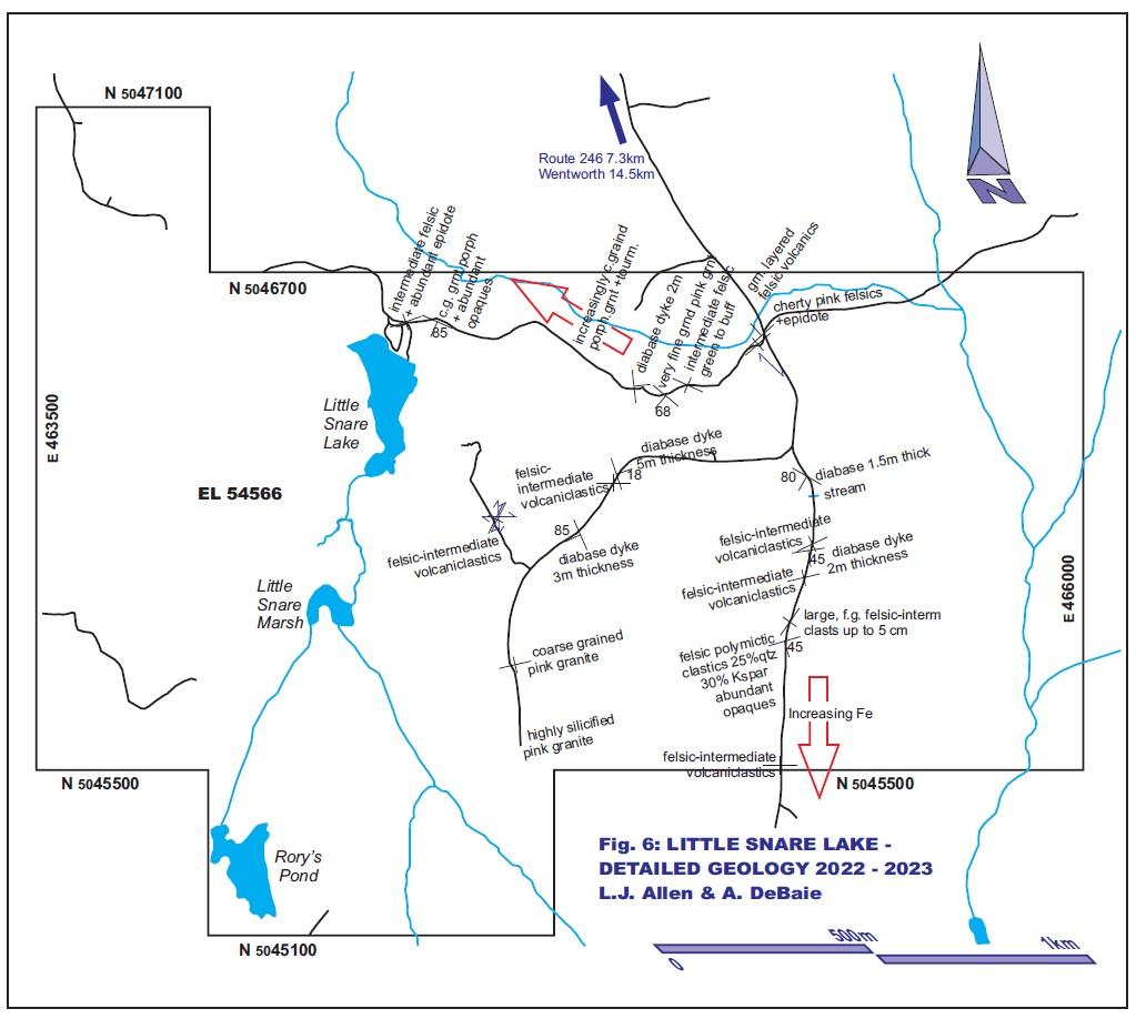
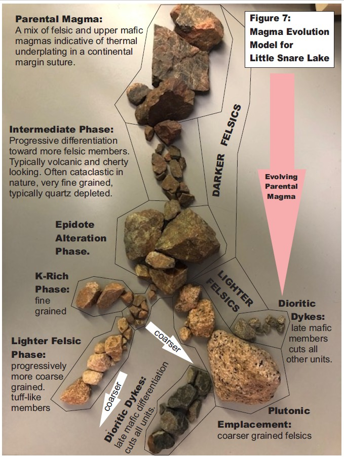
A6, A8, B13, B14, B17, D3. Zirconium 3,417 ppm at D3. Yttrium 679 ppm east-northeast of the lake. K/Rb under 75 east-southeast, a melt that kept evolving. Thorium up on the same stations. Epidote mapped at the lake, the alteration phase between the intermediate rocks and the rhyolite. Early assays confirmed the metals are in the rock. The XRF is how the next samples get chosen.
The indicators cluster
Same stations, different elements. That is the optimistic fact in the file. Not one lucky shot. A neighbourhood.
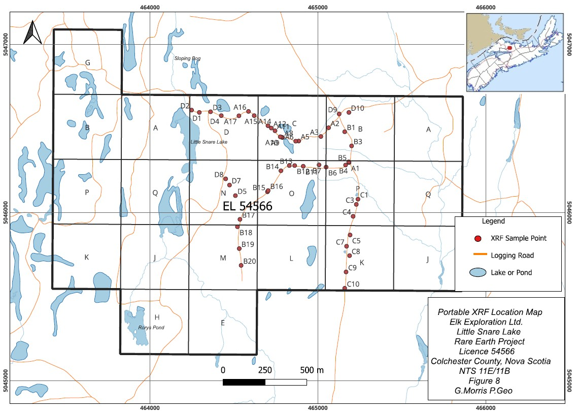
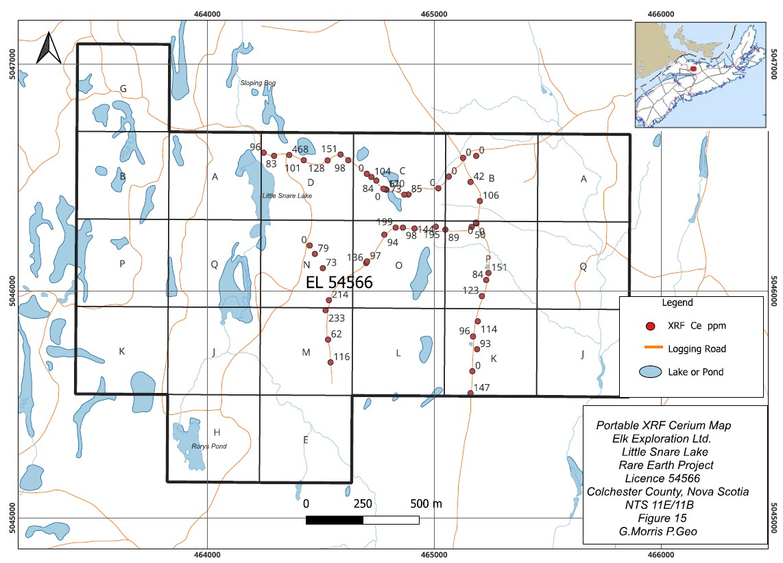
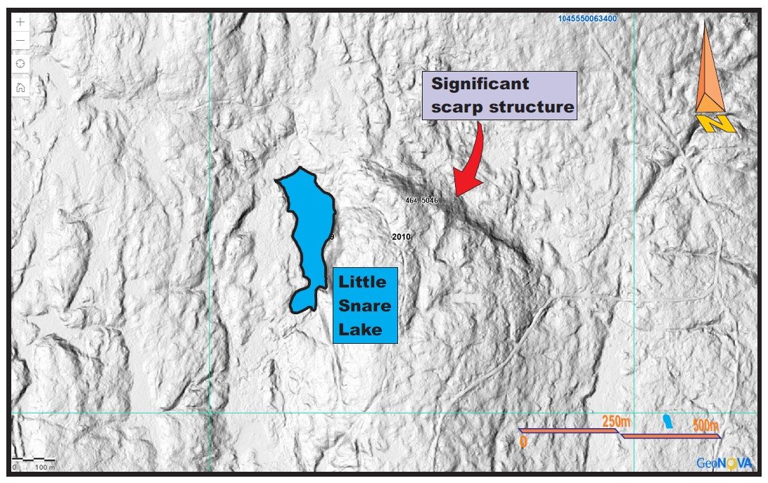
Follow-ups already dialled in: east-northeast to east-southeast of the lake, D3 by the stream on the corduroy road, A2 through A8, and the east–west road with B13, B14 and B17. Rory's Pond also has an anomaly. Fused ICP-MS next. Chondrite plots a partner can read. The licence is in good standing. The roads are in with many access points.